Explore the proposals below or view our interactive map.
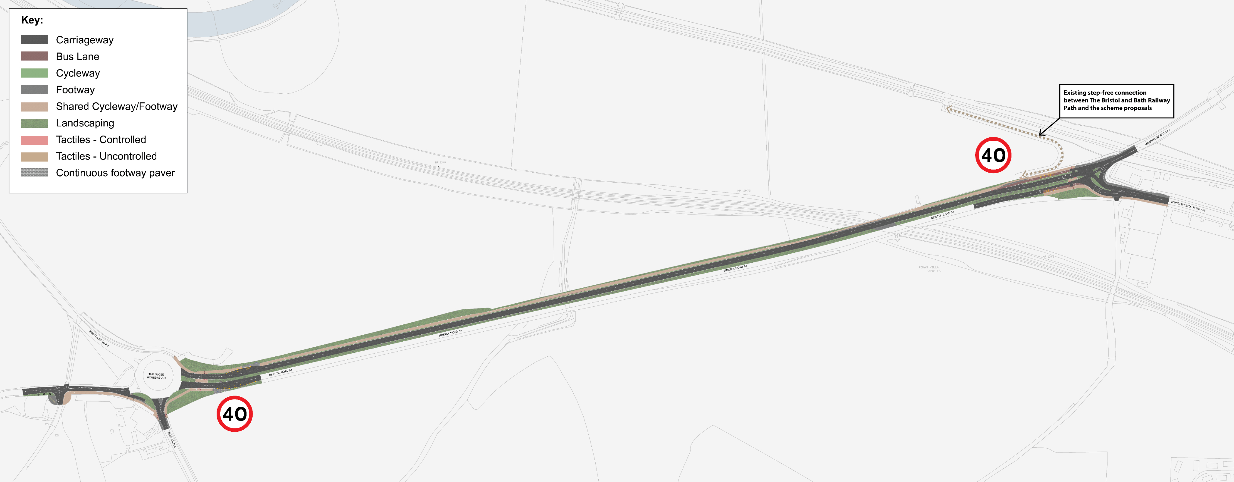
We are proposing to make the existing path shared between cyclists and pedestrians wider between the Globe roundabout and Twerton Fork (at the junction with Newbridge Road). This would be set away from the road and follow along Wells Road and Corston Drive, linking to Bath Spa University.
We are proposing changes to the junction of Corston Drive to make access to the Newton Park campus safer with better visibility. There would also be new shared crossings at the Globe roundabout.
There are no bus lanes proposed for this section except for a short stretch just before and after the Twerton Fork bus stop heading to Bath. Existing bus stops would be upgraded and made more accessible, for example by making the pavement wider.
We're also proposing to lower the speed limit to 40 mph to make it safer for people walking, wheeling, and cycling, and looking into adding new lighting along the route.
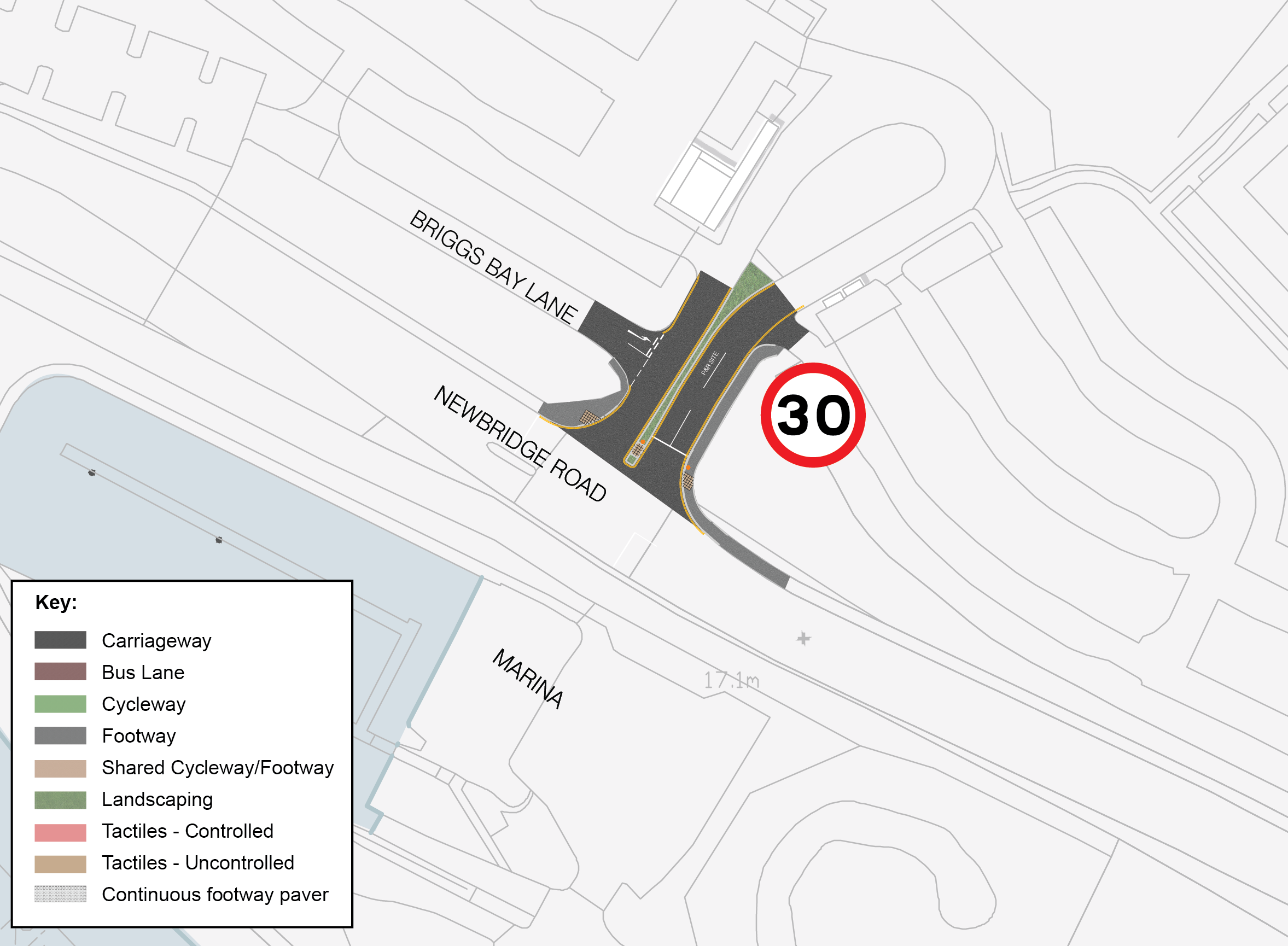
At Twerton Fork, we are proposing to improve the junctions by adding new shared crossings for both pedestrians and cyclists. This would make it safer to reach bus stops and create a continuous link from Lower Bristol Road to the A4.
This would make a direct high-quality cycling and pedestrian route along the A4 between the Newton Park campus and the Bath Spa University sports grounds.
What would this mean?
- Quicker, easier, and safer routes for pedestrians and cyclists
- Fewer delays for buses heading to Bath
- Safer and more pleasant route for people travelling to Bath Spa University
- Improved safety on the roundabout
- Improved visibility for traffic in and out of Bath Spa University
What’s changed since 2023?
- We're proposing to add two new crossings at Twerton Fork to make it easier and safer to walk between Bath and Bath Spa University
- We're no longer planning to include bus lanes in this part of the route except for a short section at Twerton Fork
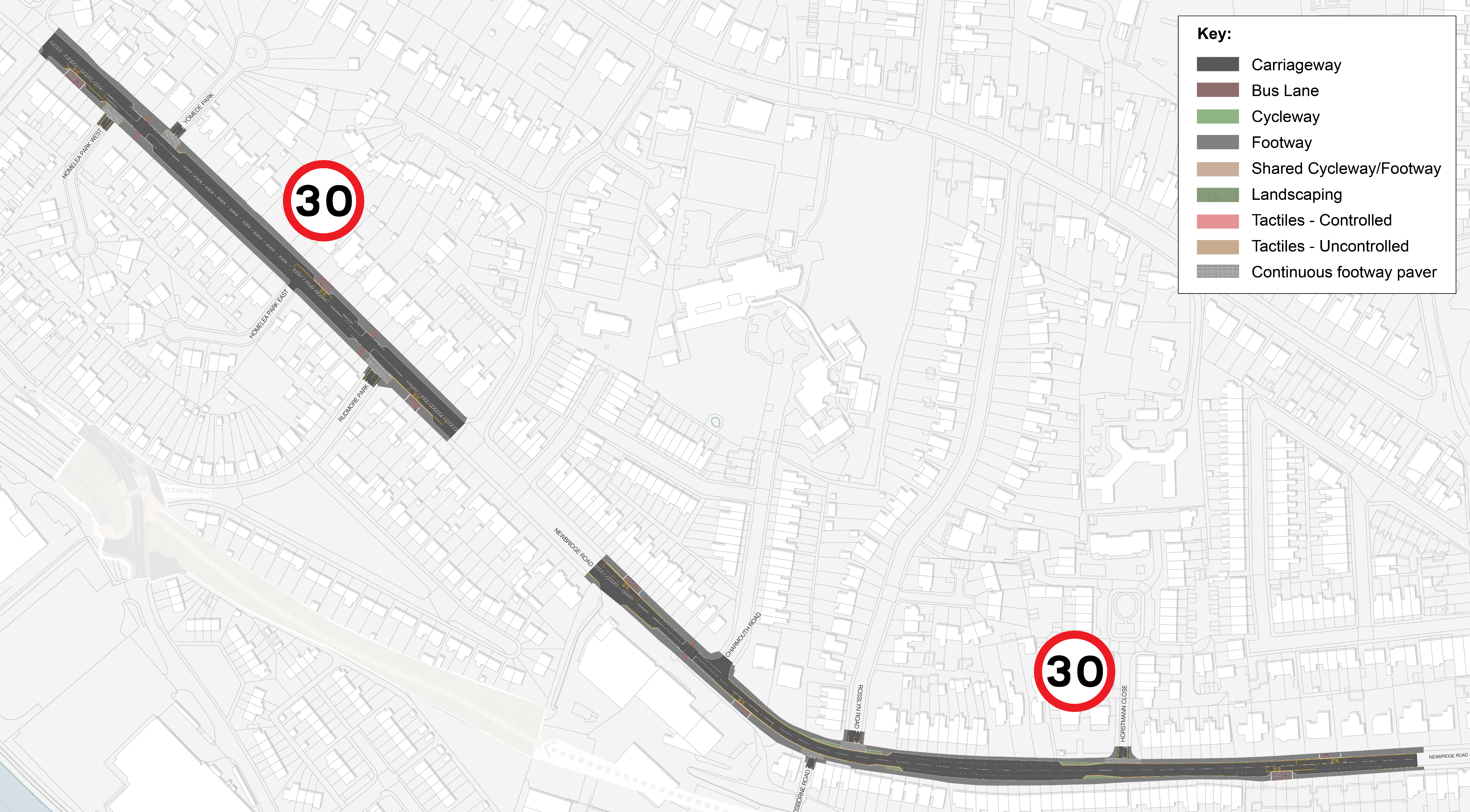
We have carried out further design work following our previous consultation and are no longer proposing new bus lanes along Newbridge Road.
A new crossing with traffic lights is proposed across Newbridge Road between the junctions of Homelea Park West and Yomede Park. Raised pedestrian crossings (built up to pavement level) are proposed across the junctions of Newbridge Road with:
- Rosslyn Road
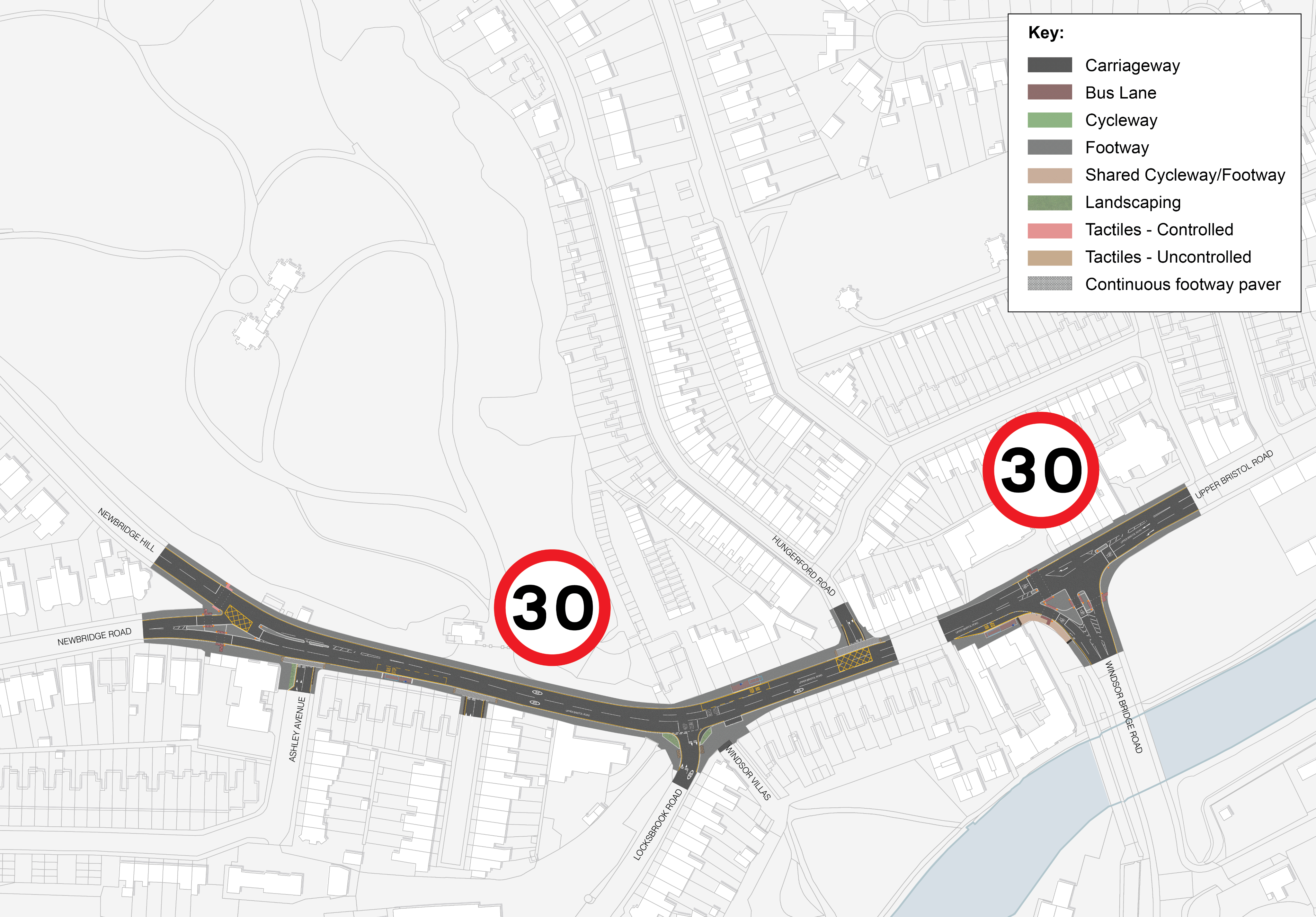
- Ashley Avenue
- Hungerford Road
These types of crossings make it easier for pedestrians to cross, especially for people using wheelchairs, mobility scooters or pushchairs.
We’re considering moving the current traffic light crossing on Newbridge Road (just west of the Chelsea Road/ Station Road junction) closer to the junction. The new crossing would be shared by people walking, wheeling, and cycling, and it would not have traffic lights.
We’ve worked with Bath & North East Somerset Council to design this junction as part of the Bath Walking, Wheeling and Cycling Links project. This will help to plan work more efficiently and keep disruption to residents and road users to a minimum during construction.
At the junction of Newbridge Road and Newbridge Hill, the traffic lights and crossings would be upgraded to give priority to buses. The road layout would stay mostly the same except that the traffic island just east of the Newbridge Hill and Newbridge Road junction would be extended to reach just past Ashley Avenue. Vehicles would only be able to turn left in and left out of Ashley Avenue. Access to Ashley Avenue will still be available via Station Road. This change would reduce delays for buses and other vehicles at the junction.
At the Windsor Bridge junction, the traffic lights and crossings would be upgraded to give priority to buses and the crossing across Windsor Bridge Road would be controlled by signals which mean cars stop for pedestrians.
We're also looking at ways to improve the traffic lights along this part of the A4 to help buses move more smoothly. This could include using GPS technology that lets the traffic lights give buses priority by staying green longer or turning green when a bus is approaching.
The new crossings designed to improve safety would mean there would be fewer spaces to park in the area, which we’ve kept to a minimum. This is estimated to be for approximately 8 cars.
What would this mean?
- Less delay for buses making them more reliable
- Change to access for Ashley Avenue
- Safer for pedestrians
What’s changed since 2023?
- We are no longer proposing any bus lanes
- Significantly less parking would now need to be removed
- We are no longer proposing to close the one-way access to the A4 along Osborne Road
We are planning to extend the Bristol and Bath Railway Path between Brassmill Lane and the River Avon Trail into Bath city centre. This would be a new half mile (850m) long shared path along the former railway track that runs between Rudmore Park and Avon Park, and between Newbridge Road and Locksbrook Road.
There would also be improvements to Station Road at the end of the new section of path to make it safer for pedestrians and cyclists to connect back to the River Avon Trail.
See the section on the Bristol and Bath Railway Path for more detail.


